 Extensis GeoExpress Unlimited 10.01
Extensis GeoExpress Unlimited, recently called Extensis is a powerful software to manage digital pictures, display, extract, and compress files map bit / pixel big. This software compresses files raster bulky by separate algorithms without compromising the quality of them. Easily open files raster as a map air, satellite, etc., and finally compress them effectively. This program has tried to prevent the compression effect when open the map and photos with the app other geographic such as ArcGis, ERDAS, etc. so you can easily compress digital photos of yourself by Opening in other software.
Extensis GeoExpress Unlimited - photo Management map
According to the manufacturer, the program Extensis GeoExpress Unlimited can reduce the image size to import up to 5 times, this is a significant figure. With GeoExpress, you can open multiple image formats TIF, GeoTIFF, BIL, ERDAS, JPEG, JPEG 2000, Sun Raster DOQs, MrSID, etc. as Soon as you open the image in the format of them, information in its metadata will be displayed. The graphical interface of the program is very simple to design and as with other Windows applications, you can easily interact with the environment.
Features of Extensis GeoExpress Unlimited
- Save disk space and memory by compressing 5x photos and map
- The ability to improve and edit images such as crop, color balance, rotate, etc.
- Translation photo mosaic
- Automatically adjust the color, contrast, and gamma for an image or series of images in preview
- The ability to crop photos and get the output in different formats
- The ability to print an image with all information in it
-
Trimble Tekla Portal Frame & Connection Designer 2019 19.0.0
 A dedicated software for BIM and the structural engineer provides the powerful tools to design the structure
-
SketchUp Pro 2026 v26.1.256
 3D modeling tools, powerful and convenient is designed for architects, designers, builders, engineers
-
Red Giant Magic Bullet Suite 2025.0
 A powerful plugin for color correction in video editing software is widely used by the filmmakers
-
Golden Software Voxler 4.6.913
 Software support you can easily visualize data components for the model of geology and geophysics
-
gInk 1.0.5
 A software on-screen captions in Windows, which is used to help improve the presentation and demonstration
-
Flaming Pear Flexify 2.987 for Adobe Photoshop
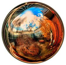 A plugin for Adobe Photoshop can help you create more artistic effects different in a photo
-
FinalMesh Professional 6.3.0.698
 Software easy and powerful the incredible to create PDF document with 3D or web pages WebGL
-
Autodesk Navisworks Simulate 2024
 Allows professionals architecture, engineering and construction, overall look, models and data integration projects
-
ABViewer Enterprise 14.1.0.76 Portable
 A powerful application, high quality and reliable will help you manage a variety of file types, technical and design
-
3D LUT Creator 1.52
 Create a file 3DLUT can be imported into many programs such as Adobe Photoshop, Adobe After Effects